Morning-after situational picture

The storm passed overnight.
See your network by morning.

All-weather radar from orbit, read against your own grid — flooded assets and disturbed corridors ranked for the first patrol of the day. No blind driving.

River flood · Poland · 16 Sep 2024
past event · real data
Radar pass after the event18 Sep · +3 days
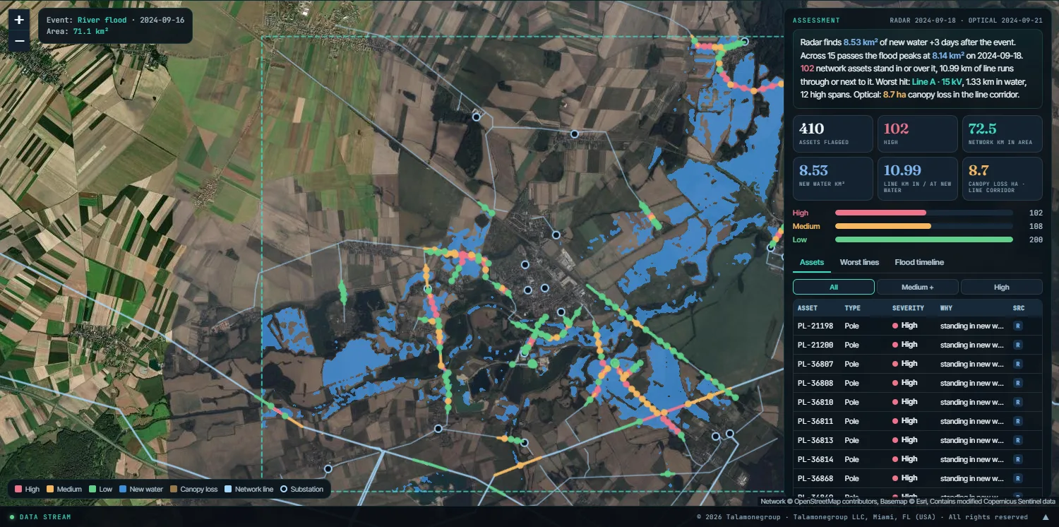
New water over the area8.5 km²
Network assets in the water102
Line in or next to the water11 km
event8.1 km² · +3 d−28 d+23 d
Every radar pass over the area, before and after the event: the flood arrives, peaks, drains.
Open this event in the live system

One area, switched on. One click after the event.

Nothing runs until you ask. The connection is readiness — not a data feed.

01

Connect your area

Register your network geometry once — corridors and substations. From then on the area is watched for events; no imagery is pulled until you trigger a look.

02

The sky is on a schedule

Orbits are predictable. We track when a satellite last passed over your area and when the next one is due — so you always know whether a fresh look just happened.

03

One click after an event

Trigger the morning assessment. We take the latest before-and-after, read what changed, and hand back a ranked picture — not a pile of raw images.

Switch on the eyes you need

Different events need different sensors. Choose per event — the right source for the weather and the detail.

All-weather radar

Sees through cloud & at night

The only reliable look in the hours after a storm, when optical is blanked out by cloud. Maps standing water and overnight disturbance in the corridor.

Daily optical

Clear-sky detail & context

Frequent revisits for colour detail and context once the weather lifts — useful for confirming and documenting what the radar flagged.

High-resolution

Sub-metre, on demand

Ordered over a specific asset when you need the closest possible look, fast — brought in only for the spots that matter.

Overpass awareness

You're never guessing whether a satellite is overhead.

For your area we show the last usable pass and the next one due. "Rapid" comes with an honest clock — a fresh look either just happened, or it's a known time away. If none is near, a new acquisition can be ordered.

Your area · pass timeline
−18h
−5h · last
+2h · next
Representative schedule. Real timing is computed from published orbits for your AOI.

What you get: a patrol order, not a pile of images

  • Flood extent over your assets

    Which substations, poles and access roads are under water — and, over the following passes, when they drain.

  • Corridor disturbance, ranked

    Where the vegetation corridor changed overnight, ordered by risk and by how reachable the span is.

  • A first-patrol order

    The map tells crews where to go first, instead of driving the whole line in the dark.
The full storm workflow, every carrier →
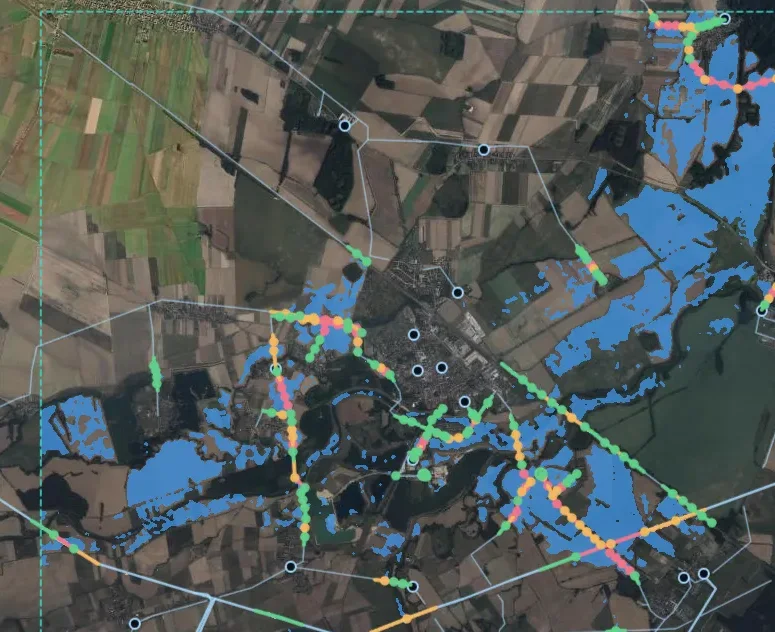
River flood seen by radar, with the power network ranked by severity
Network line New water after the event High Medium Low
From the system: river flood, 2024-09-16 · radar pass +3 days after the event, real archive data · open map network.
Radar sees through cloud
Archive first, new acquisition only if needed
Honest timing, not a fake real-time
Built for where storms hit hard — Gulf, Caribbean & beyond
See it on your ground

Watch a morning-after read, over a real event.

Three past events, read from real archive satellite data: a flash flood, a river flood and a hurricane. Switch the sensors on, see where the water sat and for how long, which lines and poles it reached, and whether a very-high-resolution scene exists for a closer look. Click any point on the map to inspect it.

The live system: sensors above, results on the map